Skip to Content

Top-Tier GIS App Development Services 


Take full control of your geospatial operations with our smart GIS mobile app solutions. Whether you’re managing a single location or enterprise-wide geographic data systems, we build custom GIS software tailored to your spatial intelligence needs. From simplifying data collection to boosting location analytics and streamlining mapping operations, our innovative geospatial solutions help businesses go digital, operate smarter, and scale faster in an increasingly location-driven world. 


Launch your organization’s geospatial transformation today  

       ​​​

Our Valuable Clients

See our case studies

abzooba
Botplan
CNH
Eldermark_Software
HAL
matrix
motherdairy
plaoalto
shiftpixy
Sports-Clips
tsi
zscaler
Transforming Business Intelligence with Smart GIS Solutions

Transforming Business Intelligence with Smart GIS Solutions

Streamline your organization’s geographic dataoperations, manage geographic datasets and mapping workflows effortlessly, connect with location intelligence in real-time, ditch the outdated manual mapping processes, and keep everything from spatial layers to geographic databases accessible on the go. Our next-gen GIS mobile app solutions are built for modern platforms giving your team the tools to analyze deeper, map faster, and decide smarter across every project. 


At qss, a leading GIS development firm and trusted partner, we bring deep expertise in geospatial and mobile app creation tailored for location intelligence and spatial analytics. Our developers build powerful GIS management apps that align with the core needs of modern businesses from geographic dataoperations workflows to location-based insights while solving the complex, behind-the-scenes challenges that slow geographic analysis down. 


Hire Expert GIS Mobile App Developers

Our Suite of Logistics & Transportation App Development Services

QSS Technosoft, a reputed logistics app development company, specializes in designing and developing logistics management software solutions with expertise in custom software development for logistics. We serve businesses across different industry verticals including manufacturing, procurement, supply chain, wholesale, travel and hospitality, and retail and e-commerce. Our app development process for logistics software includes key phases such as planning, integration of advanced functionalities, customization, and ongoing support to ensure tailored solutions for your business needs. 

Here are some of the logistics management software development solutions that we offer to help you improve operational efficiencies and internal processes: 

Vehicle/Fleet Management   

Reduce the risk that comes with vehicle management expenditure by implementing a fleet management application for comprehensive oversight, as well as managing transportation and workforce outlay. Improve productivity with our logistics management software development solutions for the seamless management of rent, insurance rate, customer, and payment methods. 

Seamless Assets Tracking     

Enable real-time tracking of shipments across domestic and international routes using GPS-enabled digital maps. Our solution offers geofencing, live updates, and automated alerts to ensure asset security. 

Improve operational visibility, reduce delays, and streamline logistics workflows. 

Manage App Schedules     

Build highly-responsive applications to manage the employee’s day-to-day schedules without mixing up. Being a trusted logistics app development company, we can help you create a customized app that you can use to manage the attendance of drivers and technicians.   

Maintenance & ongoing support   

We provide round-the-clock SLA-based support and maintenance services, enhancing customer services through responsive support, to ensure you can manage your business in a better way and improve your bottom line with high operational and responsive logistics management applications.   

Bespoke Dispatch Software    

Our extensive experience in logistics management software development, coupled with a passion for a profound understanding of leading-edge technologies empowers us to deliver computer-assisted dispatch solutions for the development of dispatch routing, mobile field dispatch, and vehicle telematics management web and mobile applications.  

Traffic Management Software Development     

Our seasoned developers can help you in the development of one-stop traffic management software, leveraging our expertise in transportation software development for the effective management of traffic networks, transportation systems, while managing traffic-related data with ease.   

Technical Consulting    

Our team of qualified consultants and developers is always ready to provide you with unwavering technical consultancy about logistics management software development and designing, including guiding you in selecting the optimal technology stack for your logistics projects.  

Shipping Logistics Management Software Development      

Streamline your shipping processes by optimizing for efficient delivery routes to minimize costs and delivery times, with customized logistics management systems designed to handle order processing, freight tracking, and real-time delivery analytics.     

Telematics Software Development     

Build high-performance telematics systems that collect and analyze vehicle data to monitor driver behavior, optimize routes, and improve fuel efficiency. Gain real-time insights with route optimization, predictive maintenance, and performance analytics. Enhance fleet productivity while lowering operational and fuel costs. 

Transportation Management Software (TMS)      

Our end-to-end TMS solutions, backed by our expertise in transportation and logistics software, help plan, execute, and optimize the movement of goods. Features include carrier selection, rate management, and freight audit and payment.   

Warehouse Management System (WMS)      

Develop scalable WMS platforms, leveraging warehouse management software to optimize inventory and warehouse processes, to streamline warehouse operations such as inventory tracking, order fulfillment, receiving, and labor management.  

Inventory Control Platform Development     

Stay on top of your inventory with custom-built platforms that leverage logistics automation for efficient inventory control and replenishment, supporting stock level monitoring, demand forecasting, replenishment automation, and reporting tools.

Custom Development Services for GIS Applications  


At Qss, a trusted agency and premier development company, we specialize in crafting high-performance geospatial solutions that meet the dynamic needs of location intelligence and spatial analytics. Here’s a snapshot of the key services we offer to improve operations, enhance geographic insights, and increase operational efficiency​:

GIS Application Development

GIS Application Development 

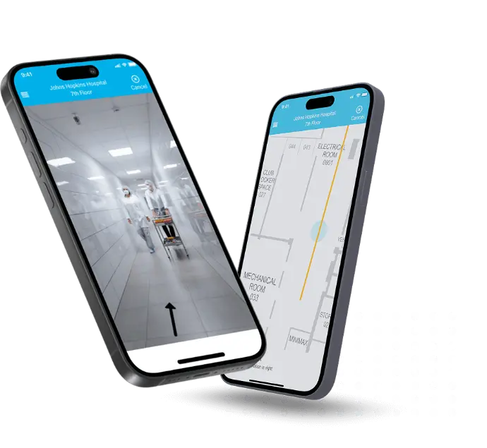
We build custom GIS applications that let you track assets, locations, or movement with precision. These apps integrate geographic data from various sources, apply accurate projections and real-world scaling, and display it on dynamic maps. Whether it's logistics, urban planning, or field data collection, our solutions help you visualize and analyze complex spatial patterns, trends, and behaviors — turning raw geodata into decision-ready insights that actually move the needle. Our expertise in spatial mapping tools ensures that your mapping applications deliver accurate and actionable geospatial information. 

GIS Database Design

GIS Database Design  

Our team designs cloud-based GIS databases that are built to scale. We work with SQL Server, Oracle, MySQL, and PostgreSQL — and connect them with GIS mapping systems using APIs like REST, SOAP, JSON, and XML. The result: fast, reliable data flow between your apps and maps. We also configure these systems to support drone-based interfaces and real-time geodata processing, so your GIS tools don’t just store data — they act on it. This robust GIS data management framework allows seamless handling of large volumes of geospatial data and unstructured datasets. 

GIS Programming Services

GIS Programming Services  

We don’t just build GIS tools — we engineer the guts behind them. Our developers have deep experience with C++, Java, Visual Basic, XML, and more, enabling us to program robust, high-performance GIS software from the ground up. Whether you're integrating GIS into an enterprise stack or building a niche application from scratch, we make sure the code holds up to complex spatial logic, performance demands, and cross-platform compatibility. Our comprehensive software development approach ensures your GIS solutions are scalable and maintainable. 

Data Capture Solutions

Data Capture Solutions  

We design GIS tools that capture, clean, and process geospatial data in real time. Whether you're working with satellite imagery, drone footage, aerial photography, or remote sensors, our systems help you collect accurate location data fast — and turn it into structured information that’s ready to use. These solutions are ideal for fieldwork, agriculture, infrastructure, and environmental monitoring, where ground truth and up-to-date intelligence matter. Our focus on real time analysis enables rapid decision-making based on the freshest geographical data. 

Data Management Solutions ​

Data Management Solutions ​

Your GIS platform is only as strong as its data architecture. We build modules that organize both spatial and non-geographic dataoperations into clean, usable structures — including geodatabases, feature classes, tables, topologies, and relationship models. That means faster queries, better visualizations, and smarter decision-making across the board. Whether you're managing public infrastructure or private assets, our solutions help you make sense of the layers underneath your map. Effective GIS data management is at the core of our gis development services, ensuring data integrity and accessibility.

Image Management Solutions

Image Management Solutions 

Managing geospatial imagery shouldn’t be a bottleneck. We automate image workflows using Mosaic Dataset Configuration Scripts (MDCS) and Python-based geoprocessing tools. These solutions handle large raster datasets — from drone captures to satellite tiles — with speed and consistency. Whether you’re stitching mosaics, running classifications, or extracting features, our tools make it seamless. Perfect for teams working in agriculture, defense, disaster response, or any field where imagery drives action. 

Why Choose QSS for GIS App Development? 


At QSS, we combine deep geospatial experience with scalable software engineering to deliver custom GIS apps that streamline operations, enhance location intelligence, and boost operational efficiency.

Here's what sets us apart:  

24x7 Technical Support & Consultation

24×7 Technical Support & Optimization 


We don’t disappear after launch. Our team is available round-the-clock to handle bugs, upgrades, and performance tuning so your app keeps running smoothly. 

Highest Security  Standards

Rock-Solid Security Standards


We bake security into everything—encrypted data transmission, secure access systems, role-based controls, and compliance with data regulations. Your geographic data and business stay protected.

Cross-function AI Team of  Experts

Cross-functional Development Team Built for Geospatial Services 


From UX designers and mobile app developers to GIS engineers and cloud architects—we bring together a full-stack team with spatial development expertise and hands-on experience to design, build, and optimize your GIS app from end to end, ensuring it meets your specific workflow requirements.​

On-Time Delivery with Transparent Processes

On-Time Delivery with Transparent Workflows  

You get updates, not surprises. We use agile sprints and tools like Jira or Trello to keep you in the loop at every step—ensuring timely delivery without sacrificing quality. 

14+ Years of Digital Product Engineering ​

14+ Years of Geospatial Product Experience  

With over a decade of experience building apps for data-intensive industries, we understand the complexity of spatial operations—and we design products that solve real geographic analysis challenges, allowing businesses to gain deeper insights and actionable intelligence.

Agile Development  Approach

Agile GIS App Development Process   

We build, test, and adapt. Our agile process lets us move fast and stay flexible as your organization’s spatial needs evolve without missing a beat.  

Technology Stack We Use for GIS App Development
We build GIS apps using tools that are fast, reliable, and ready to scale—from real-time spatial tracking to backend database systems. Here’s what powers our platforms

What Sets Our GIS Tech Capabilities Apart

We don’t just build GIS apps; we design spatial solutions that connect every geographic component of your operations. From data collection to decision-making, we make sure your platform runs fast, smart, and secure. 

We build GIS apps for Android and iOS with fast load speeds, smooth UI, responsive design, and consistent multi-device performance. Our GIS app development company specializes in crafting apps that perform flawlessly across multiple platforms. 

We deploy secure, scalable cloud environments so your GIS platform handles high data volume and processing without crashes or server downtime. This infrastructure is a core part of our gis software development services.   

We implement real-time tracking for assets, smart sensor integrations, and route optimization without relying on external third-party APIs or tools. These advanced features are part of our GIS app development solutions.
 

We implement strong encryption, secure architecture, and full compliance with global standards to protect spatial data and ensure legal safety. Security compliance is integral to our GIS app development company’s offerings. 


We connect your app with your existing ERP, database, and analytics tools through custom API development to streamline operations and reduce manual data entry errors. Our app development company ensures seamless integration.
 

We build clean, interactive dashboards with live spatial data so managers can track operations, analyze patterns, monitor performance, and identify geographic trends instantly. Analytics are a key component of our GIS app development solutions, providing actionable insights and supporting strategic decision making.


We provide post-launch support, performance monitoring, and fixes under strict SLAs, ensuring your GIS tech always runs at full capacity. Our GIS app development company commits to long-term partnerships.

Industries We Serve with Our GIS App Development

GIS apps aren’t just for traditional mapping anymore. Our solutions flex across a wide range of industries—each with its own challenges, workflows, and spatial requirements. Whether you’re optimizing logistics routes or monitoring environmental changes, we build tech that fits your business—not the other way around.  ​

Advanced Technologies We Employ for Modern GIS App Development 

At QSS, we use forward-thinking tools and tech stacks to build GIS apps that are fast, scalable, and built for how organizations collect, analyze, and act on spatial data today.

Cloud & DevOps

Cloud-Based Spatial Processing

Centralized backend systems that connect multi-source data, processing platforms, and visualization tools — all managed from one intuitive control panel. 

Big Data & Analytics

Predictive Spatial Analytics

Track geographic patterns, environmental changes, and operational trends to forecast conditions, optimize resource allocation, and reduce operational risks.   

Smart Data Integration Systems

Smart Data Integration Systems 

Cloud-based integration setups that sync data across collection methods, processing tools, and visualization platforms, with real-time updates and seamless workflows.   

Automated Mapping & Analysis Tech

Automated Mapping & Analysis Tech   

Automated systems for data processing, spatial analysis, and report generation — so teams aren’t overwhelmed and insights aren’t delayed. 

Real-Time Data Collection & Processing

Real-Time Data Collection & Processing 

Sensor-based data capture, automated processing, and instant visualization — creating faster, more accurate spatial intelligence for both teams and stakeholders.   

Cloud & DevOps

Cloud & DevOps

Enable real-time operations, seamless updates, and continuous integration with scalable, cloud-native infrastructure backed by CI/CD pipelines. 

Big Data & Analytics

Big Data & Analytics

Unlock insights from your logistics data to optimize delivery routes, forecast demand, and improve decision-making through smart dashboards.   

Internet of Thing

Internet of Things (IoT) 

Track vehicles, assets, and inventory in real-time using smart sensors—improving traceability, reducing downtime, and enhancing operational control.   

GPS & Location Technology

GPS & Location Technology   

Ensure accurate fleet tracking, geofencing, and route optimization for faster deliveries and reduced fuel costs. 

Blockchain

Blockchain

Add transparency and security across your logistics chain with tamper-proof digital ledgers for transactions, inventory movement, and smart contracts.   

Our Success Stories 

Real results, real apps, built for accuracy, scale, and spatial intelligence. Here’s how we’ve helped organizations go from data to decisive action.   

Start Your GIS App Journey with the Best GIS App Developers

Ready to digitize your spatial operations and enhance location intelligence? Partner with Qss, one of the best GIS app developers and a trusted GIS app development company, to build scalable, user-friendly GIS apps tailored to your business needs. 

Let’s simplify the process: 

1

Share Your Vision

Tell us about your organization, goals, and spatial requirements—our experts will guide you through the best features and technology options. Our GIS app development solutions begin with understanding your unique needs. 

2

Get a Custom Quote

Receive a tailored, transparent estimate based on your app functionality, design requirements, and timeline. We provide competitive pricing as a leading app development company.

3

Sign NDA

We protect your data, processes, and business model—our NDA ensures complete confidentiality and IP security. Trust is paramount in our GIS app development company. 

4

Kickstart Your Project 

Once aligned, we start bringing your GIS app to life with agile methods, seamless collaboration, and quality code. Our GIS app development solutions ensure smooth execution from start to finish. 

Let’s Transform Your Spatial Operations

Let’s Transform Your Spatial Operations  

Looking to build a dedicated mobile app to streamline geographic workflows, boost location intelligence, and deliver seamless spatial analysis experiences? 
  

Let’s talk about how QSS, a top GIS app development company and experienced app development company, can turn your vision into a high-performing geospatial solution available on multiple platforms including the Apple App Store and Google Play. 

Get a Free Consultation​​​​​​​​

In-Depth FAQs Clients Actually Ask

The development costs of GIS apps depend on app complexity, integrations, and the kind of spatial intelligence you’re aiming to deliver. If you’re scaling enterprise geographic operations or running multi-location analysis, off-the-shelf mapping tools won’t cut it. You’ll need something custom—built to handle high data volume, complex spatial processing, and consistent performance across geographic regions. 

Qss develops GIS apps that are optimized for accuracy, efficiency, and scalability—whether it’s a high-volume data processing system or a multi-location spatial intelligence platform. 

Key Cost-Saving Benefits of Custom GIS Apps 

  1. Centralized Multi-Location Data Management 
    Manage spatial datasets, analysis workflows, and reporting across multiple sites with a single admin panel. Cut down on repetitive manual data processing. 
  2. Integrated Data Source & Platform Sync 
    Connect directly with satellite feeds, drone data, or IoT sensors to reduce third-party licensing costs and improve data quality. 
  3. Automated Processing & Analysis Flow 
    From data capture to visualization output, automation reduces processing errors, delays, and rework. That’s real operational savings. 
  4. Team Optimization & Role-Based Access 
    Assign specific permissions and project controls to reduce unauthorized access, optimize workflows, and manage licensing costs better. 

How It Improves Operational Efficiency

  1. Faster Data Processing Time 
    Instant data routing and analysis estimations help teams prioritize and complete spatial analysis without bottlenecks. 
  2. Live Data & Analysis Coordination 
    Link data collection with processing teams and visualization platforms. Everyone sees what’s next, in real time. 
  3. Unified Stakeholder Communication 
    Send real-time alerts for analysis completion, data updates, or project milestones—no need for manual status calls. 
  4. Actionable Geographic Insights 
    Track project-level performance, processing time, data quality, trending patterns, and operational feedback from one smart dashboard. 

At Qss, we don’t just build apps we build spatial intelligence systems that move fast, scale smart, and make your geographic operations run like clockwork


Running spatial operations isn’t just about good maps anymore—it’s about speed, precision, and intelligence. If you’re juggling field collection, data processing, and analysis on different systems (or worse, spreadsheets), things break. Data gets lost. Analysis sits incomplete. Decisions get delayed. What you need is a custom-built GIS app that actually matches how your spatial workflows run. 

At Qss, we build GIS apps that aren’t just functional—they’re built for how you work. One platform that connects your field teams, analysts, and decision-makers. Everything streamlined. Nothing lost in translation. 

Here’s what that looks like: 

Smart Data Collection System 
Let field teams capture, validate, and upload geographic dataoperations with ease. Real-time processing status, quality checks, and seamless office integration make this the backbone of spatial operations. 

Spatial Analysis & Processing Management 
Ditch the analysis bottlenecks. Let analysts access field data, run processing workflows, and generate insights through automated tools and real-time collaboration features. 

Mobile-First Field Data Capture 
Maps on phones = faster collection and zero data loss. Field teams use GPS, capture photos, record measurements, and send data straight to processing—no missed locations, faster project completion. 

Integrated Database & Workflow Management 
Connect your field operations with your analysis teams. Data flows straight from collection to processing to visualization. No double entry. No version conflicts. 

Project Tracking & Team Collaboration 
Keep projects moving forward. Track collection progress, assign analysis tasks, and automate updates based on workflow status and team availability. 

Real-Time Data Sync & Notifications 
Send push or system updates when data is collected, processed, or ready for review. Teams know what’s up without constant check-ins. 

Quality Control & Validation Management 
Stay accurate without over-processing. Track data quality, manage validation workflows, and get alerts when issues need attention—before they become project problems. 

Analytics & Performance Dashboard 
See what projects are progressing, when your peak collection times hit, and which workflows actually worked. Make decisions backed by operational data, not assumptions. 

With Qss, you’re not just managing geographic dataoperations you’re running a data-driven, insight-first operation built for geographic intelligence

Frequently Asked Questions

A GIS (Geographic Information System) app lets you capture, store, analyze, and visualize spatial or geographic data. It’s not just maps. It’s about insights — helping you make better decisions based on location intelligence, whether you're managing assets, tracking deliveries, planning infrastructure, or responding to emergencies. 

Yes. We’ve built GIS apps for urban planning, agriculture, logistics, oil & gas, public safety, utilities, and more. Every use case is different — so we tailor the features, data layers, and analytics engine to your exact operational needs. 

Absolutely. We’re fluent in open-source GIS tools like QGIS, Leaflet, GeoServer, and OpenLayers. If you want a cost-effective, license-free setup, we can build around that. We also work with proprietary systems like ArcGIS if needed.   

  Yes. For field teams with poor connectivity, we build offline-first GIS apps that store data locally and sync automatically when the device is back online. This is especially useful in forestry, mining, and rural infrastructure projects.

We support satellite imagery, street maps, terrain layers, heatmaps, weather overlays, and even real-time sensor feeds. If the data exists, we can turn it into a map layer — and make it interactive and actionable. 

We integrate GPS, GNSS, and even drone data to improve accuracy. Depending on the hardware used and your requirements, we can achieve sub-meter precision — which is more than enough for most enterprise use cases. 

Yes. We build APIs to connect your GIS app with ERPs, CRMs, asset management platforms, field service tools, and more. Your spatial data shouldn’t sit in a silo — it should work with the rest of your tech stack.

Definitely. We can enable real-time location tracking, set up geofences to trigger alerts or actions when an object enters/exits a boundary, and even monitor changes over time. Great for fleet tracking, environmental monitoring, and incident response.

We use encrypted data channels, secure authentication (OAuth2, SSO, etc.), and role-based access controls so only the right people see the right data. For sensitive operations, we can also restrict GPS sharing or anonymize certain layers.  

Yes. We offer onboarding, documentation, and hands-on training for your internal team. Post-launch, you’ll have access to regular updates, bug fixes, performance optimizations, and priority support whenever you need it. 

Recent Blogs

Check out our latest blogs here.

Your Dynamic Snippet will be displayed here... This message is displayed because you did not provide both a filter and a template to use.